Canyelles – Olèrdola – Puig de l’Àliga
A semicircular route, not difficult at all, suitable for everyone despite its size. The itinerary is very complete and runs along the border with the Alt Penedès region, following one of the most interesting ridges in the Garraf region due to the wide panoramic views that can be seen. Spectacular views and the secular heritage of Olèrdola await us.
Data of interest
Canyelles- Distance: 13,24 Km
- Unevenness: 485 m
- Approximate duration: 3h 45m
- Difficulty: Mitja
- Thematic: Landscape / Nature
At the crossroads of carrer Major and Balsa de Llot de Canyelles, start the route along the path that goes up the Pla del Bosc stream, marked with a flag. Pass through the Cogullada and Daltmar housing estates to head first towards the Olèrdola complex and then towards Puig de l’Àliga, following the signs on the ridge and the GR 92.3 continuity markers. The return to Canyelles is along a connecting path that goes off to the right (southeast) about 200m down from Puig de l’Àliga.
This semi-circular route is suitable for everyone. A very complete route along one of the most interesting ridges in the Garraf, the county border with the Alt Penedès. Spectacular views and the secular heritage of Olèrdola await us.
Places of interest
-

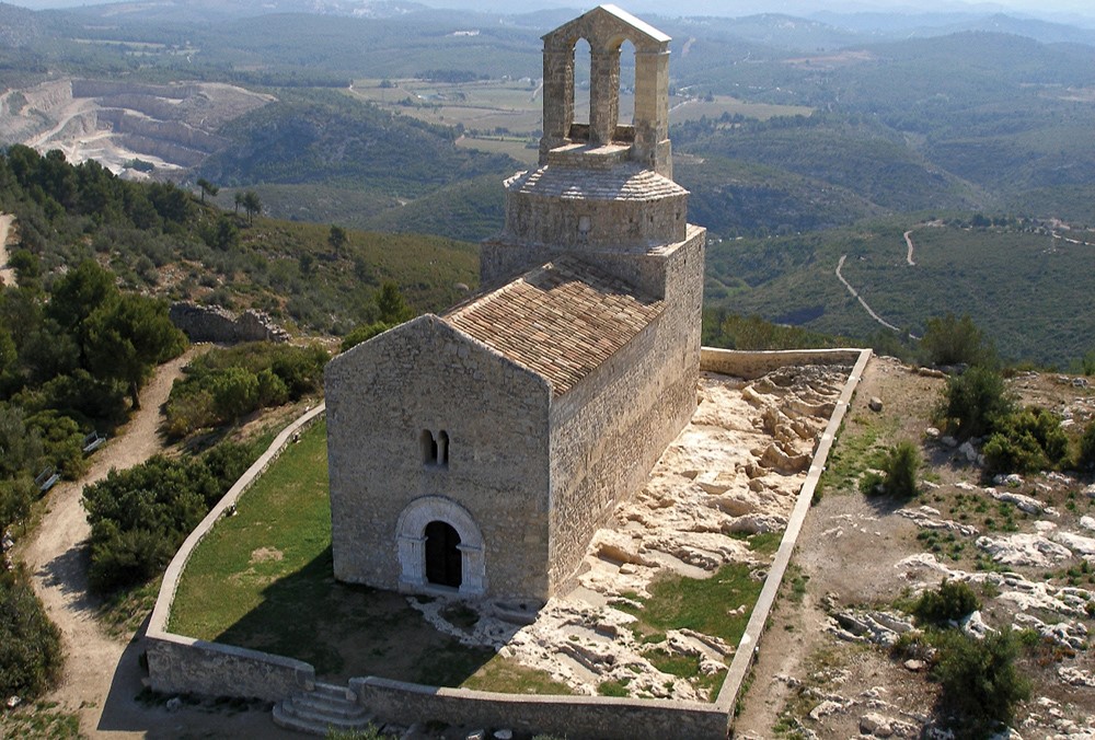
Olèrdola complex
From the first settlers we have found the remains of a tomb located near the present-day entrance area. The first settlement protected by a wall dates from the beginning of the Iron Age (8th century - beginning of the 6th century BC). Between the 5th-4th and 1st centuries BC, Olèrdola was occupied ...
From the first settlers we have found the remains of a tomb located near the present-day entrance area. The first settlement protected by a wall dates from the beginning of the Iron Age (8th century - beginning of the 6th century BC). Between the 5th-4th and 1st centuries BC, Olèrdola was occupied by the Cessetans, one of the Iberian peoples that occupied the Catalan coastal area. The Iberian oppidum (fortified settlement) was of considerable size (3.5 ha) and its inhabitants settled on the lower part of the rocky platform, adapting the pre-urban structure to the orography of the terrain and taking advantage of the existing wall. To the right of the entrance gate to the enclosure were various craft workshops that operated between the 4th century and the end of the 3rd century BC, including a dyeing and/or tanning factory, the only one documented in the Iberian world.
In 1963 the Diputació de Barcelona acquired the estate. In November 1971, after some alterations to the church and the construction of a new building on the site of a former farmhouse-rectory, the Olèrdola monument complex was opened to the public. In 1995, the monumental complex of Olèrdola became one of the sites of the Archaeology Museum of Catalonia, and since 2014 it has been managed by the Catalan Cultural Heritage Agency. Olèrdola was declared a Cultural Asset of National Interest in 1931 and an Asset of Cultural Interest (BIC).
see more
see less
-
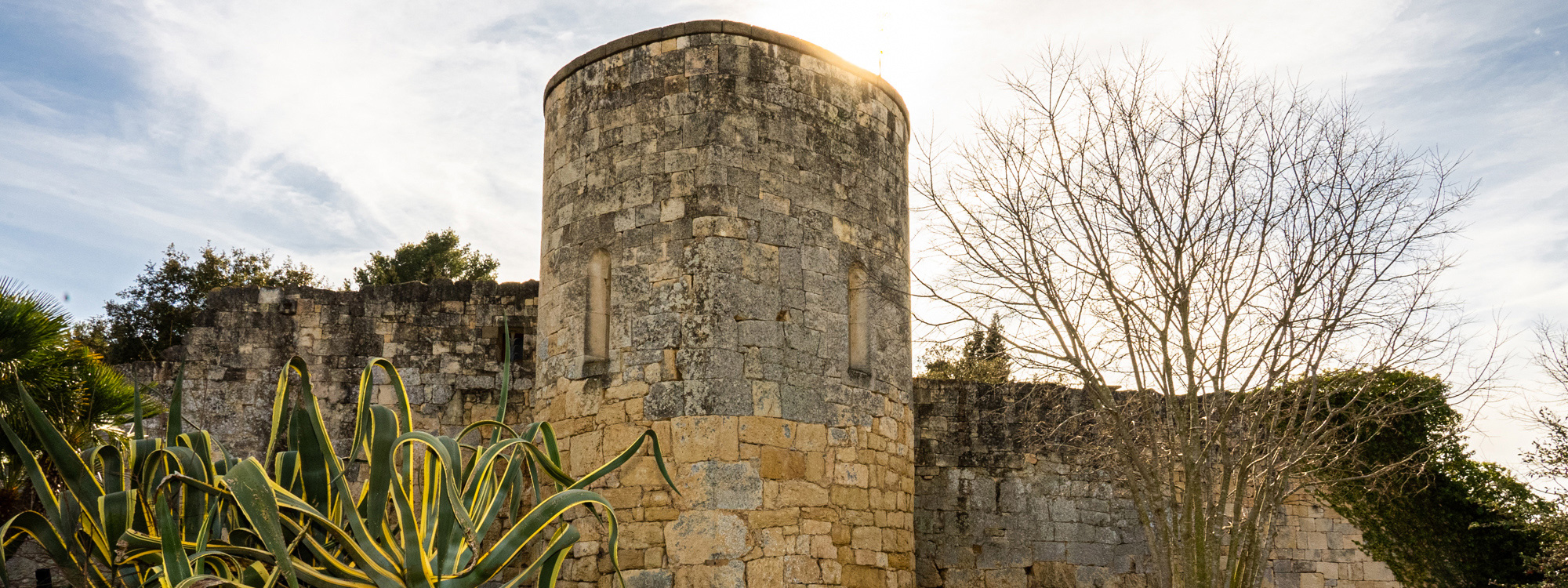
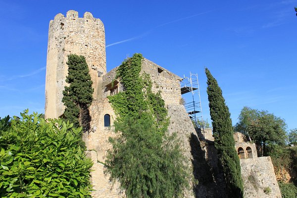
Canyelles Castle
The village is defined by the monumental ensemble of its castle and church, located on the top of a hill at an altitude of 142m, which can be seen from all the accesses to the municipality. The castle is documented as dating from the 15th century, when it was owned by Franci Terré, Lord of ...
The village is defined by the monumental ensemble of its castle and church, located on the top of a hill at an altitude of 142m, which can be seen from all the accesses to the municipality. The castle is documented as dating from the 15th century, when it was owned by Franci Terré, Lord of Canyelles, but it is hypothesised that it was originally a defence tower for the great bastion of Olèrdola.
The remains that remain from this period consist of a circular tower and a fragment of wall with five battlements. Nowadays, it is a privately owned castle that was rebuilt by the owner himself, and it is currently used by the Town Council for popular activities.
see more
see less
-
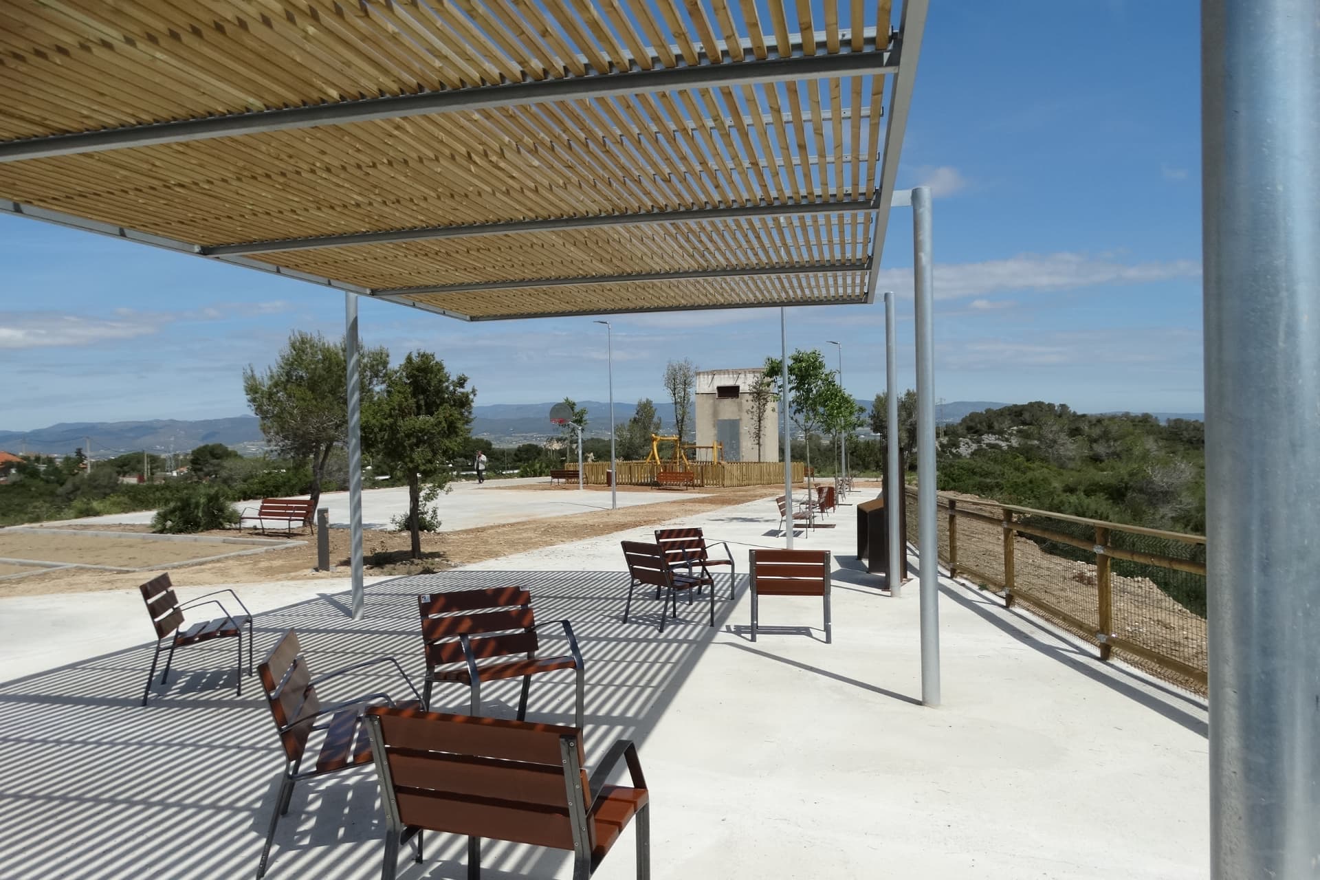
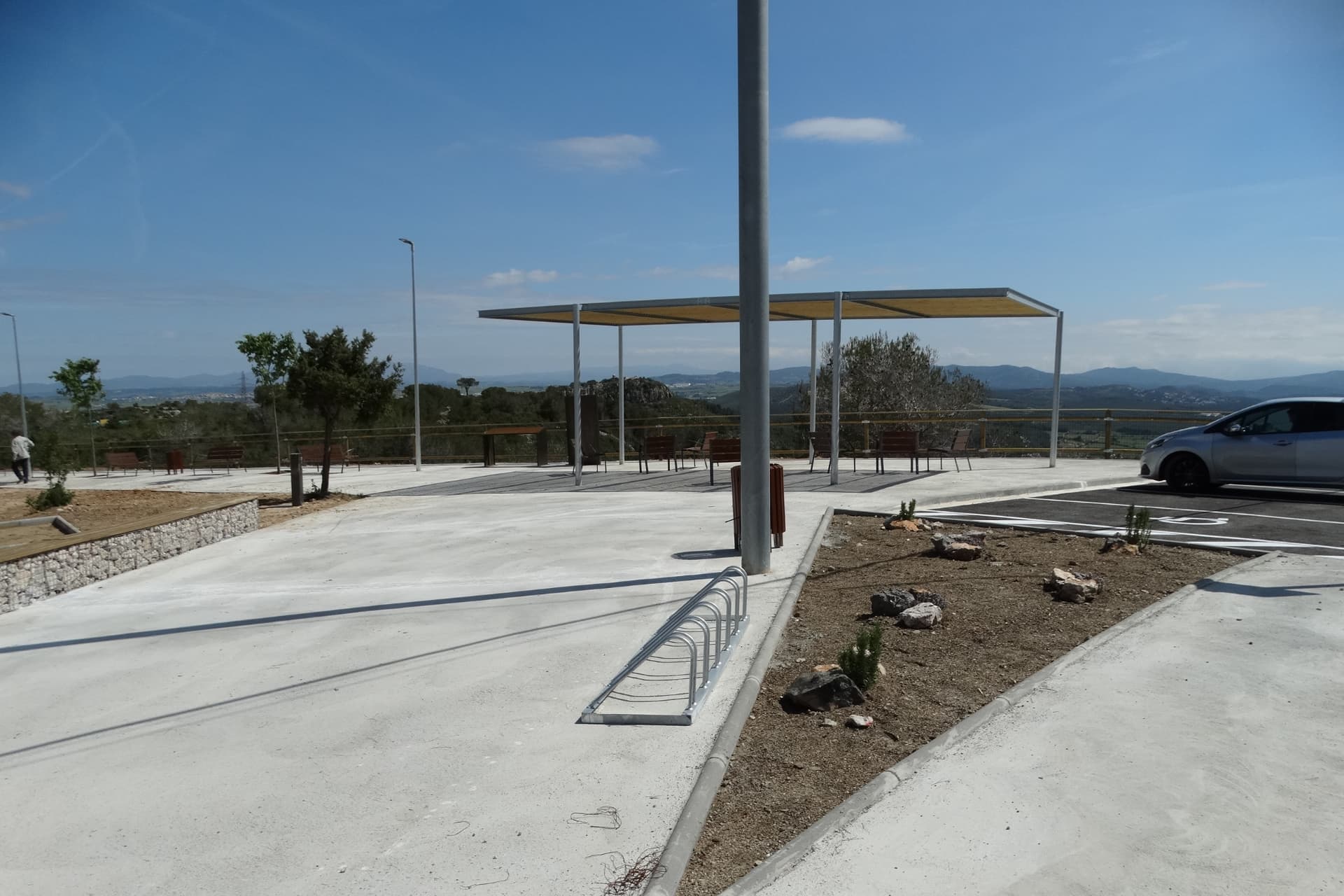
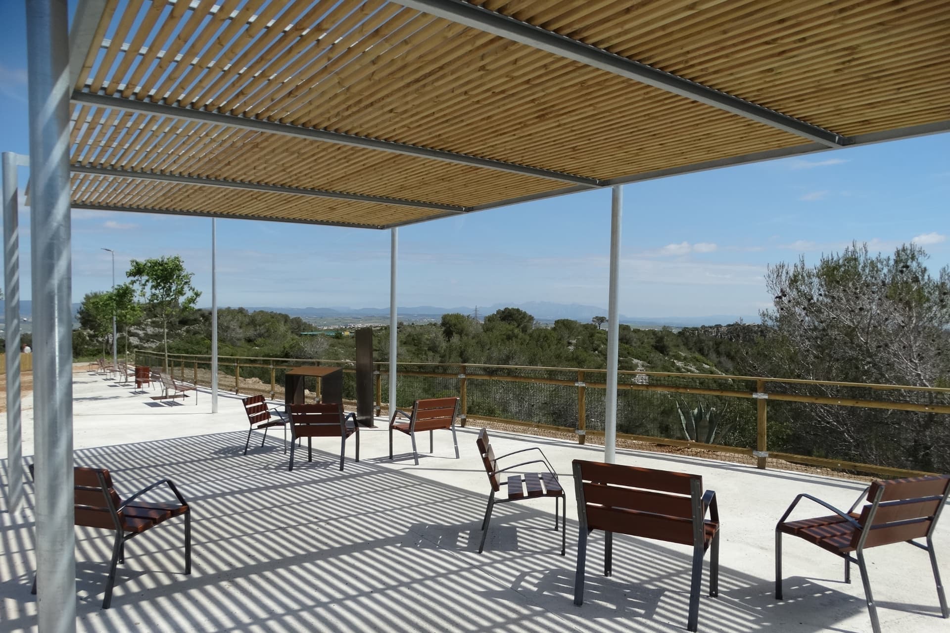
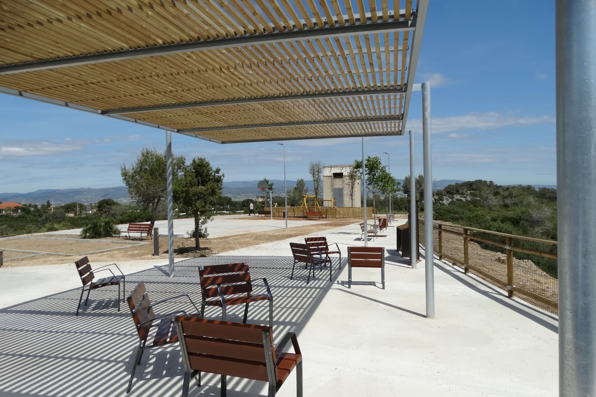
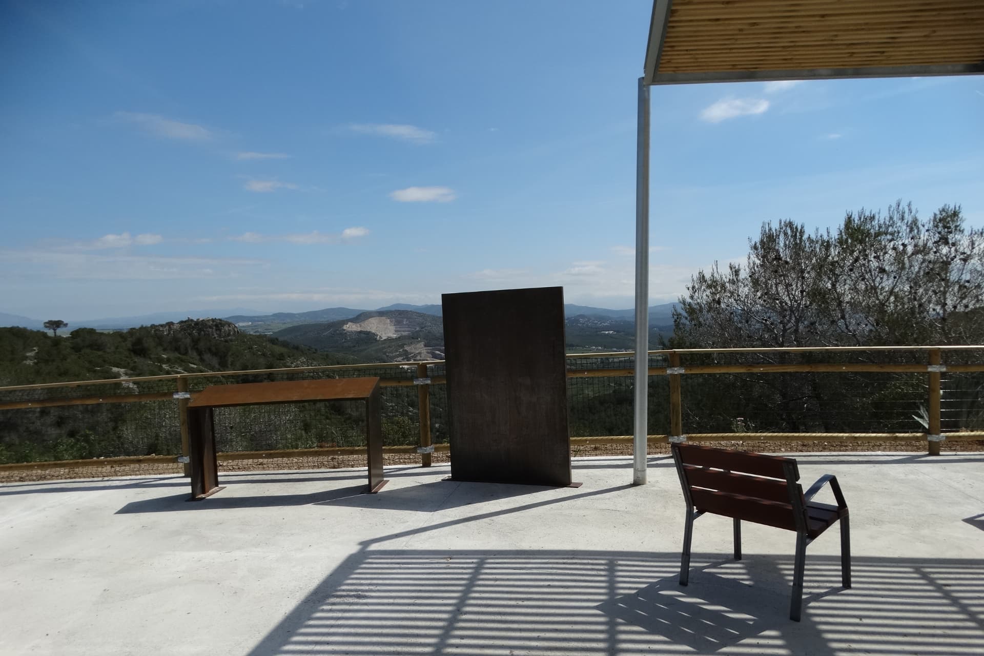
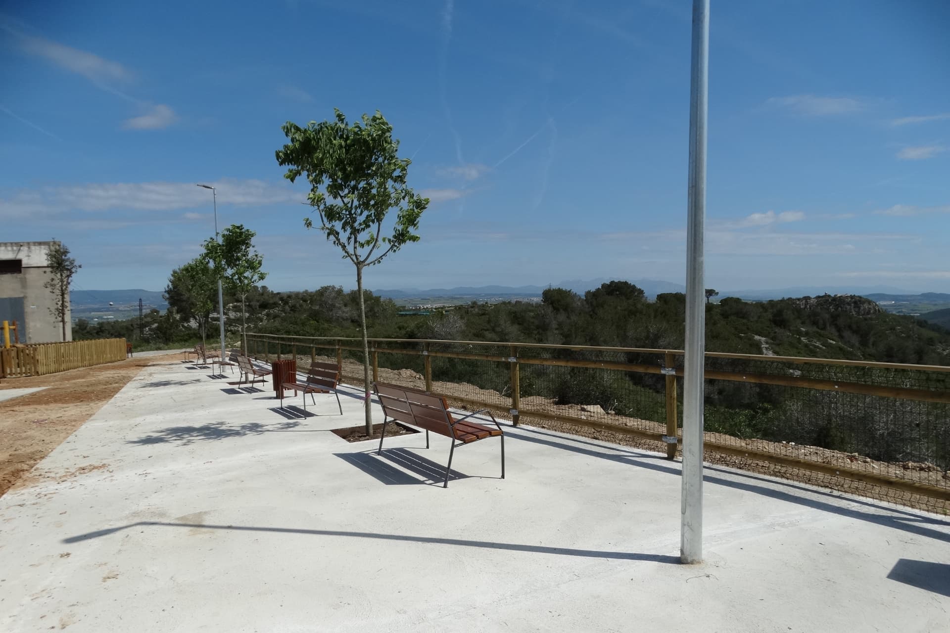
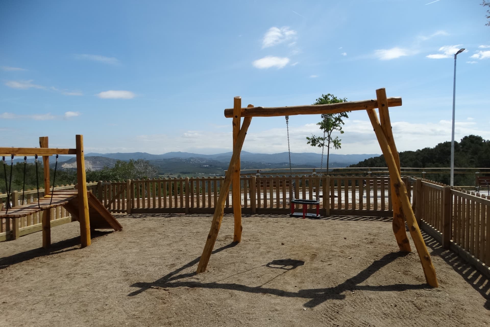
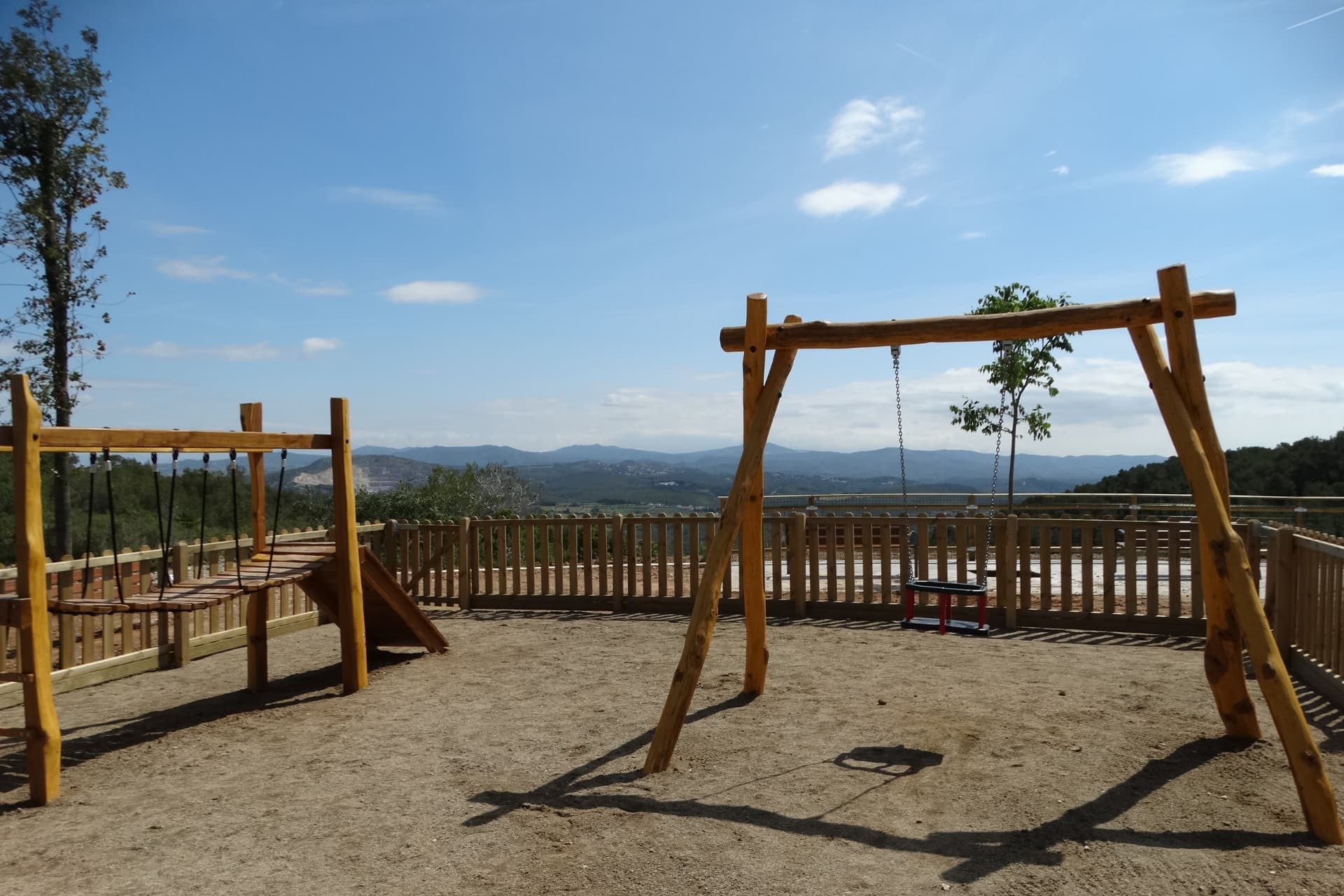
Olèrdola and Montserrat Park Viewpoint
The construction of the Montserrat Viewpoint is part of the Garraf: paths, heritage and nature regional project, and has been co-financed by the European Regional Development Fund (ERDF). The work began in January and the needs of the residents of Daltmar have been taken into account when defining ...
The construction of the Montserrat Viewpoint is part of the Garraf: paths, heritage and nature regional project, and has been co-financed by the European Regional Development Fund (ERDF). The work began in January and the needs of the residents of Daltmar have been taken into account when defining the project. Their participation and contributions have been taken into account in the design of this space that recovers the sector.
The project has made it possible to completely transform an obsolete and degraded space, formerly used as a road system, into a space for enjoyment that is fully integrated into the Olèrdola Park. Due to its strategic location on the Pic de l'Àliga mountain range, one of the highest points in the territory, the new Montserrat Viewpoint is a great window on the Olèrdola natural park and also on the mountains of Montserrat.
see more
see less
-

-
-
-
-
-
-
-
-
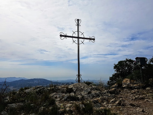
Puig de l’àliga
At the crossroads of carrer Major and Balsa de Llot de Canyelles, start the route along the path that goes up the Pla del Bosc stream, marked with a flag. Pass through the Cogullada and Daltmar housing estates to head first towards the Olèrdola complex and then towards Puig de l'Àliga, following ...
At the crossroads of carrer Major and Balsa de Llot de Canyelles, start the route along the path that goes up the Pla del Bosc stream, marked with a flag. Pass through the Cogullada and Daltmar housing estates to head first towards the Olèrdola complex and then towards Puig de l'Àliga, following the signs on the ridge and the GR 92.3 continuity markers. The return to Canyelles is along a connecting path on the right (southeast) about 200m down from Puig de l'Àliga.
see more
see less
Find it at: Puig de l’Àliga panoramic route
Discover other routes
-
Canyelles – Olèrdola – Puig de l’Àliga
Canyelles- DISTANCE 13,18 Km
- WEATHER 3h 45m
- UNEVENNESS 447 m
-
-
Ruta Del Mirador De La Punta Grossa
Sant Pere de Ribes Sitges Vilanova i la Geltrú- DISTANCE 8,25 Km
- WEATHER 1h 30m
- UNEVENNESS 121 m
-
-
Vilanova – Castillo de Miralpeix – Sant Pere de Ribes
Sant Pere de Ribes Vilanova i la Geltrú- DISTANCE 24,01 Km
- WEATHER 2h 30m
- UNEVENNESS 235 m
-